
Using Data to Determine the Best Location for Wildlife Corridors for Wolf Restoration
GIS Project. December 13, 2017
By Joely Nelson
Using data from WDFW, WSDOT, and Defenders of Wildlife, I used ArcGIS to determine the location of barriers to wolf spread to the Pacific Coast Region, and propose road sections where the construction of wildlife corridors could help wolf dispersal into this region.
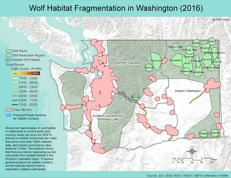
I followed the assumptions of Richard Walker and Lance Craighead who created models to find places where connectivity could be increased in the Northern Rockies in Montana. These assumptions are:
- Humans pose problems for successful transit
- Good corridors are composed primarily of preferred habitat types
- Current human developments are permanent.
Made for the final project of Geography 360 at the University of Washington.
Written on December 13, 2017